Last chance to submit your workshop proposal or abstract for a presentation for the regional FOSS4G BE + NL conference in Baarle Hertog/Baarle Nassau! Languages: Dutch, French & English. Submit here before 22 July: https://foss4g.be/en/ @osgeonl #osgeo #foss4g #foss4gbenl @qgisnl #qgis


Update Announcement!!!
Version 2024.3.0 of the Mergin Maps mobile app just released today. This update comes with Android Fused Location Provider for improved accuracy and battery life, GPS centred on your location when recording a new feature and more: https://github.com/MerginMaps/mobile/releases/tag/2024.3.0

This new video demonstrates how to use the Vertical Controller to visualise wind data in #QGIS. The example shows #HurricaneBeryl using mesh NetCDF data from @CopernicusECMWF. :qgis: https://youtu.be/p4lRqgFUyx0

Thank you, @mbernasocchi for sharing the journey so far

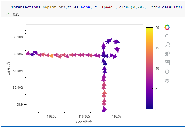
Trajectools 2.2 released
If you downloaded Trajectools 2.1 and ran into troubles due to the introduced scikit-mobility and gtfs_functions dependencies, please update to Trajectools 2.2. This new version makes it easier to set up Trajectools since MovingPandas is pip-installable on most systems nowadays and scikit-mobility and gtfs_functions are now truly optional dependencies. If you don't install them, you simply will not see the extra algorithms they add ...
TIL about a new @qgis plugin dealing with #GTFS thanks to the #openaccess proceedings of the academic track at @foss4geurope
City Transport Analyzer: A Powerful #QGIS Plugin For #PublicTransport Accessibility And Intermodality Analysis
Paper:
https://isprs-archives.copernicus.org/articles/XLVIII-4-W12-2024/113/2024/
Plugin:
https://github.com/gianmarconaro/city-transport-analyzer
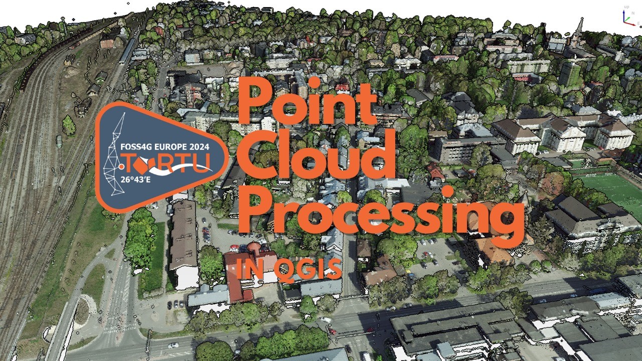
Tomorrow, at @foss4geurope I'll give the workshop #PointCloud Processing with #QGIS together with Saber Razmjooei from @lutraconsulting. Follow along with the free materials at https://courses.gisopencourseware.org/. During the conference, you can also get a discount on my course at Udemy: https://www.udemy.com/course/qgis-pointcloud/?couponCode=FOSS4GETARTU #FOSS4G

QGIS Quick Tip 04!
Get instant data insights with the Statistics Panel.

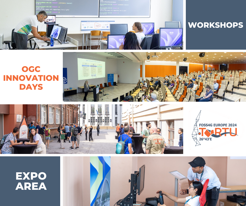
🚀Day 1 of FOSS4GE 2024 kicked off brilliantly with:
👏Hands-on workshops, OGC Innovation Days, and a vibrant expo area showcasing cutting-edge innovations and networking opportunities.
🤩Excited for more learning and connections tomorrow!
#foss4ge2024 #foss4g #tartu
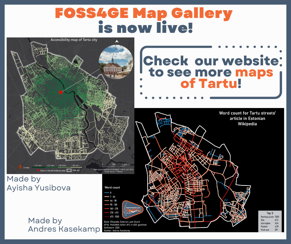
The FOSS4GE Map Gallery is now live!🤩
A big thank you to everyone who submitted their maps!🗺️
Don't forget to check out the awesome and unique maps of Tartu on our website👉https://2024.europe.foss4g.org/map-gallery/
#FOSS4GE2024 #FOSS4GE #FOSS4G

Call for presentations FOSS4G NL&BE 2024
Deadline: 8 juli 2024
https://www.linkedin.com/posts/erikmeerburg_call-for-presentations-foss4g-nlbe-2024-activity-7210879198016528386-J-3f

#G3WSUITE 3.8 DOCUMENTATION! Consult the new online manual and tutorial Access the demo to discover the new integrations with #QGIS!
https://g3w-suite.readthedocs.io/en/v3.8.x/index.html
https://g3wsuite.it


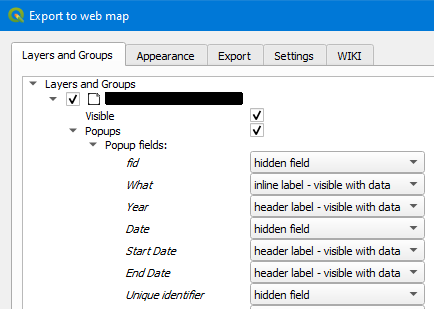
Finally getting to work with qgis2web again, and am impressed by all the improvements that Andrea Ordonselli (not on Mastodon?) has been making! #qgis
It's now a lot easier to configure what fields show in popups -- hide a field if empty, always hide, etc.
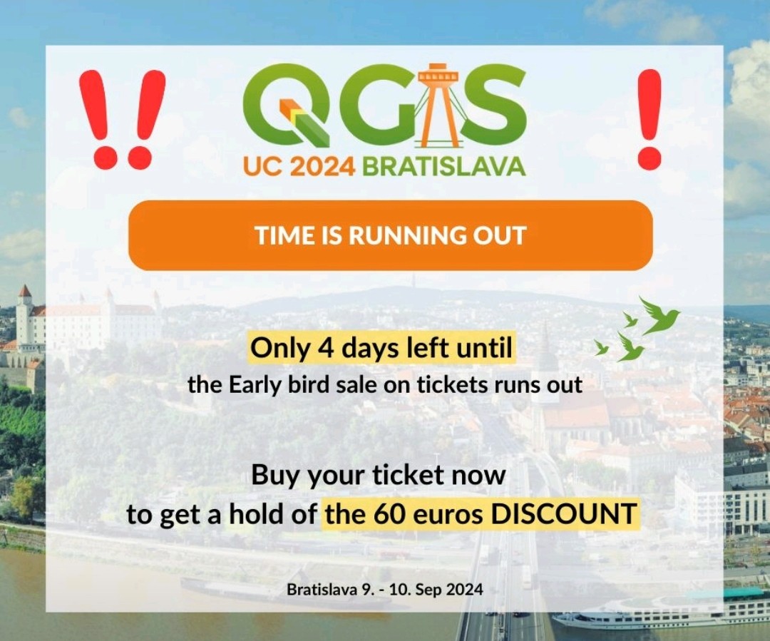
Don't forget to get your Early Bird tickets for the @qgis User Conference, 9-10 September in Bratislava. A great opportunity to get in touch with the amazing #qgis community. I'll be joining with the #WAPlugin team & Razan Elnour, supported by the #QGISHydro Book Fund. Check the program for our workshops & presentations and get your Early Bird tickets asap! :qgis: 💚 https://uc2024.qgis.sk/ @foss4geurope @osgeo
#QGIS 3.38 Grenoble has been released and it has many nice new features! This new video highlights one that is particularly useful for visualisation of raster-based outputs of dynamic models, such as made with #PCRaster. Thanks for this feature @northroadgeo! #QGISHydro https://youtu.be/dL8kpqdiReg

Interesting podcast if you are interested in learning more about the geoparquet file format: https://open.spotify.com/episode/0ugH6HO5Szz1cD1WgV5aAx?si=9044a9e0222c4ae5
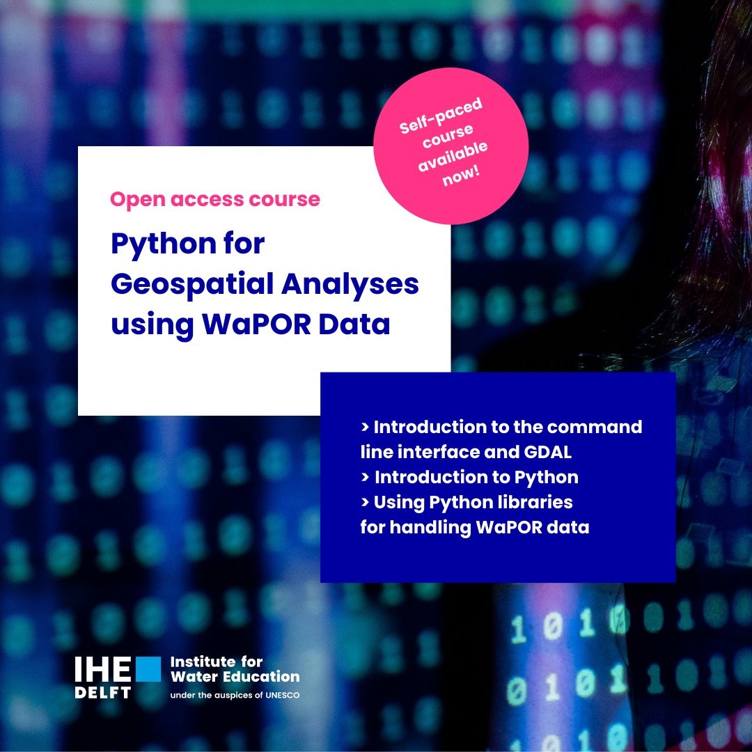
New #WaPOR #MOOC available now! #Python for #geospatial analyses using WaPOR data. #IHEDelft #FAO #WaterProductivity
More information: https://edu.nl/q877u
Woa, just in time 😅
@movingpandas v0.18.0 just landed on pypi and conda-forge
For an overview of all new features and improvements, see
https://github.com/movingpandas/movingpandas/releases/tag/v0.18
Example notebooks will be updated later. Now it's time for #esc2024
#MobilityDataScience #MovementDataAnalytics #Mobility #GeoPandas #DataScience #GIScience #GISChat #OSGeo #MovementData #VisualAnalytics

I have set up a brand new website for my professional activity. The inauguration comes with new blog post:
https://aneto.pt/posts/tutorials/2024-05-11-create-easy-pyqgis-developement-environment-using-conda-and-vscode/
QGIS users! https://youtu.be/aRlCy-jfZbU
Learn how to create isochrones in just 1 minute.🚶🏼♀️🚗🗺️
#qgis @qgis #cartography #mapping