Expect partly cloudy skies with temperatures remaining around 25 degrees through early afternoon.

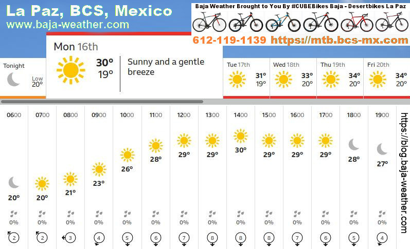
Monday, 14. December 2020: Plenty of sunshine to expect for today, peak temperatures near 25°C, winds NNW at 10 to 15 km/h. Sunrise 06:57 hr, sunset 17:37hr. According to forecast predictions you can apply this to about every day the coming week.
#BajaNews #BCSNews #PeninsulaNews #BajaClima #BajaWeatherChannel
https://blog.baja-weather.com/post/637488951141253120/14-21december

Friday, 11. December 2020: The sun comes up at 06:53 hr. During the morning hours sunny intervals with light rain
http://blog.baja-weather.com/

Monday 30.November 2020 expect sunny skies with temperatures rising to 23°C degrees through midday.Sunrise was at 06:48 hr, sunset is 17:34 hr. For the rest of week the forecast is very similar. There is a slight chance of rain coming Saturday.
https://blog.baja-weather.com/post/636222184827813888/30nov2020

Saturday 28. November 2020 - Plenty of sunshine forecast today.. High 26C. Winds N at 25 to 40 km/h.

A mix of clouds and sun. High 33C. Winds N at 10 to 15 km/h.
Image: 24 Nov 2020 - 19:42 UTC

Forecast Monday 23. November 2020 for today, and very similar, the rest of the week, we can expect an abundance of sunshine, peak temperatures expected 33°C. Winds SW at 10 to 15 km/h.
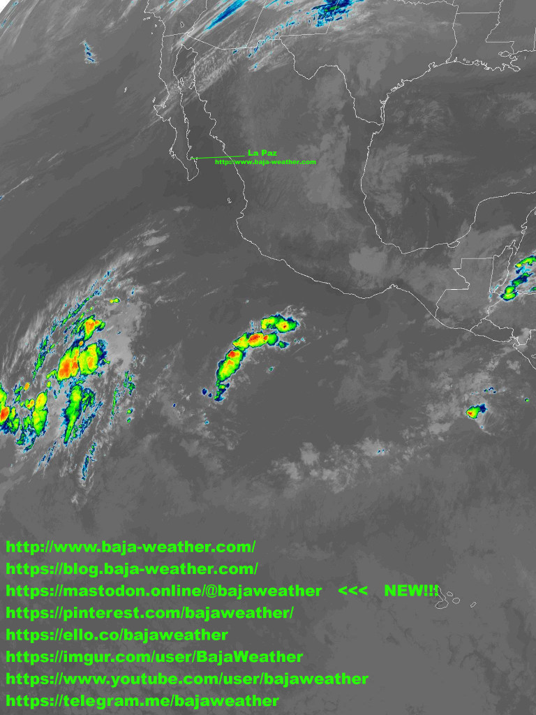
A trough of low pressure located several hundred miles south-southwest of the southern tip of the Baja California peninsula continues to produce disorganized showers and thunderstorms.
More >>> https://blog.baja-weather.com/post/635589547485528064/23nov2020
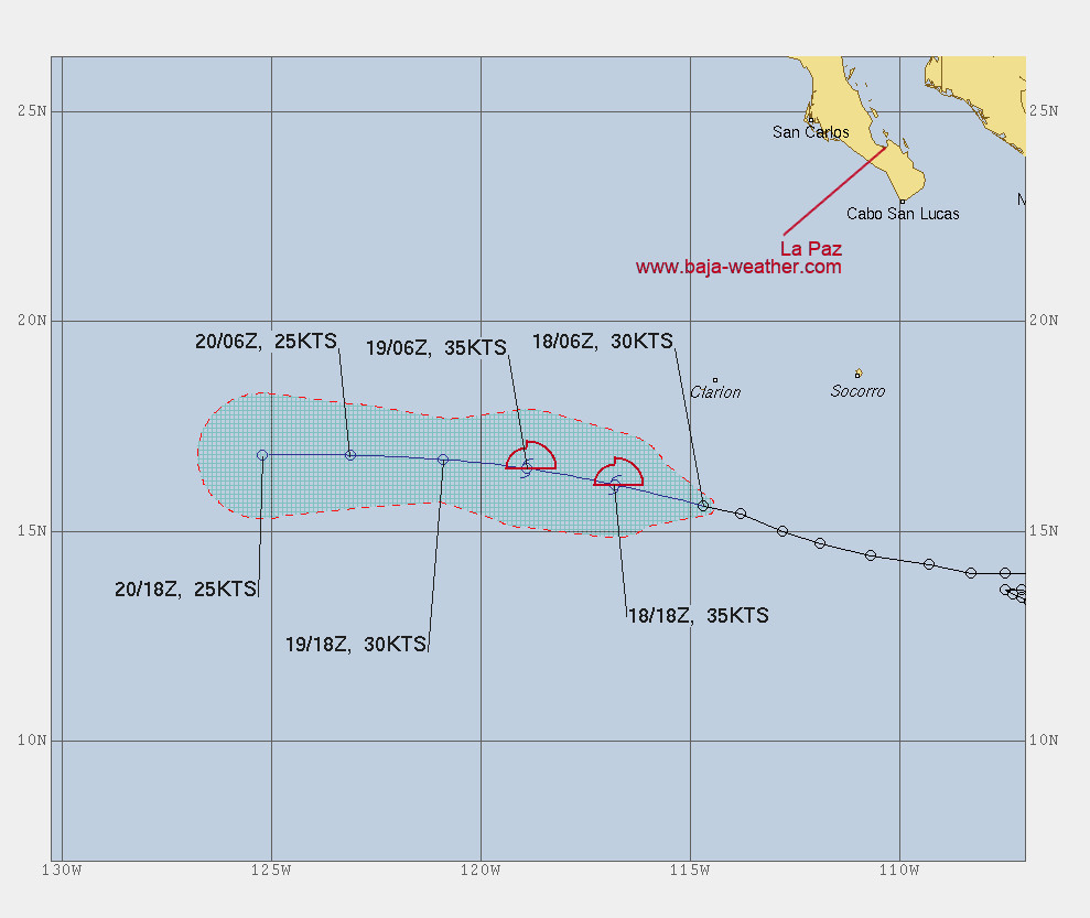
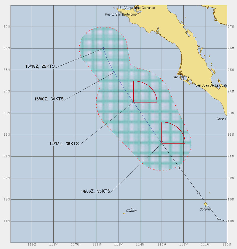
At 01:00 hr PST (09:00 UTC), the center of Tropical Depression Twenty-One-E was about 975km (605 mi) of the southern tip of the Baja peninsula.The depression is moving toward the west-northwest near 19km/h (12 mph), and this general motion is expected to continue today, followed by a turn toward the west by Thursday.
Weakening is expected to begin by Thursday, and the system is forecast to become a remnant low in a couple of days.
https://www.pinterest.com/bajaweather/

Additional development of this system is expected to be
slow to occur over the next few days. The disturbance is forecast
to move slowly west-northwestward or northwestward away from the coast of Mexico. Conditions are expected to become unfavorable for further development around midweek.
https://ello.co/bajaweather
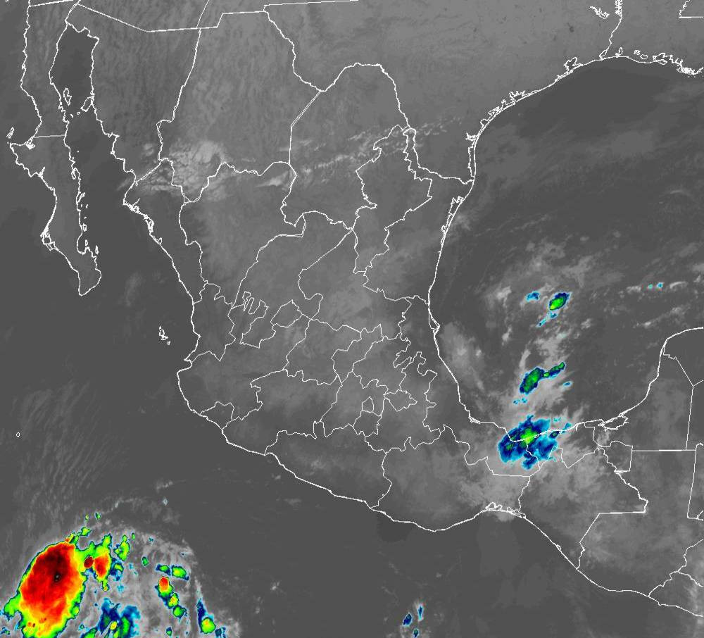
Monday 16. November 2020 and the remainder of the week we can expect similar climate conditions as the past week with the exception that we have a system out in the Pacific which should not impact us. Showers and thunderstorms associated with a broad area of low pressure located several hundred miles southwest of the coast of southern Mexico have become a little better organized overnight.
Sunrise today will be at 06:38. the sunset at 17:35
https://blog.baja-weather.com/post/634944329561096192/16nov2020
Monday 9. November 2020 - Mainly sunny, peak temperatures expected 28°C. Winds NNW at 15 to 25 km/h.
Sunrise at 06:34hr, sunset 17:38hr
Visit https://blog.baja-weather.com/

2. Nov 2020 - 16:11 UTC - 09:11 La Paz time
https://www.pinterest.com.mx/pin/101331060360696466
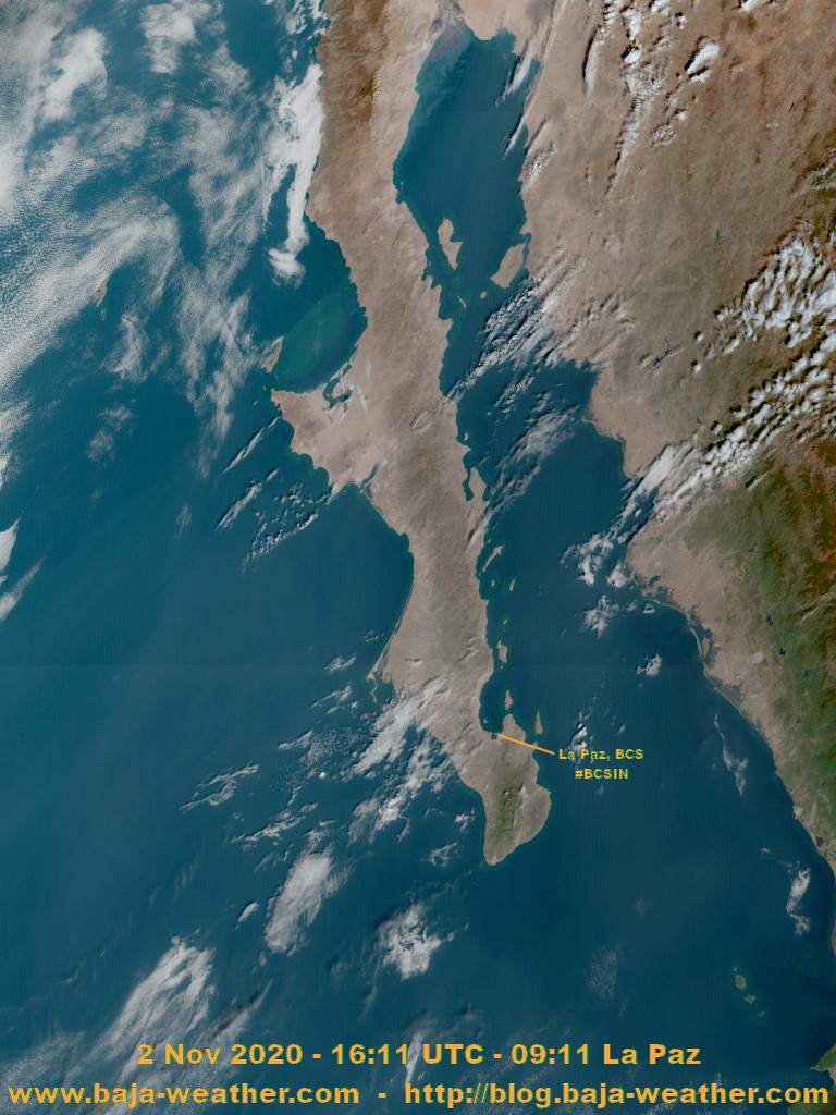
Expect mostly clear skies with temperatures rising to 28 degrees this morning. For the rest of the day (and more or less at least the first half of week) abundance of sunshine with peak temperatures around 32°C. Winds NNE at 15 to 30 km/h.
A trough of low pressure located several hundred miles south of the southern tip of the Baja California Peninsula is producing a broad area of disorganized showers and thunderstorms.
https://blog.baja-weather.com/post/633671560197242880/2ndnov2020

With every day similar weather we kinda got curious how the “big” (national or global) weather forecast services do write comments for the daily focast. At Aeris Weather it states: “Expect sunny skies with temperatures rising to 25 degrees through midday” and the famous Weather Underground forecast is: “Sunny. High 28C. Winds N at 15 to 30 km/h.”
Not much we can ad to that!
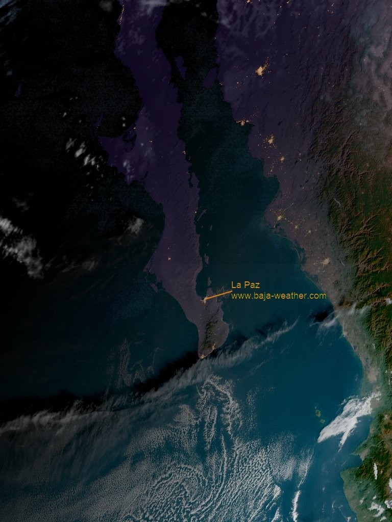
It’s a beautiful morning in La Paz, maybe a little windy for the folks going out on the boats.

GOES-East satelitte pass 23. October 2020 - 20:37 UTC / 14:37 hr La Paz time.
Literally everything is clear for the weekend!
Monday 19. October 2020, forecast predicts plenty of sunshine, peak temperatures during afternoon at 37°C, winds WNW at 10 to 15 km/h. The rest of the week should be very similar. There is also no hurricane activities expected during at least the coming 48 hours.
https://blog.baja-weather.com/post/632413779074940928/19october2020

Forecast for Wednesday 14. October 2020 is partly cloudy, peak temperature 34°C, winds SW at 10 to 15 km/h. Sunrise at 07:19hr and sunset 18:56hr.
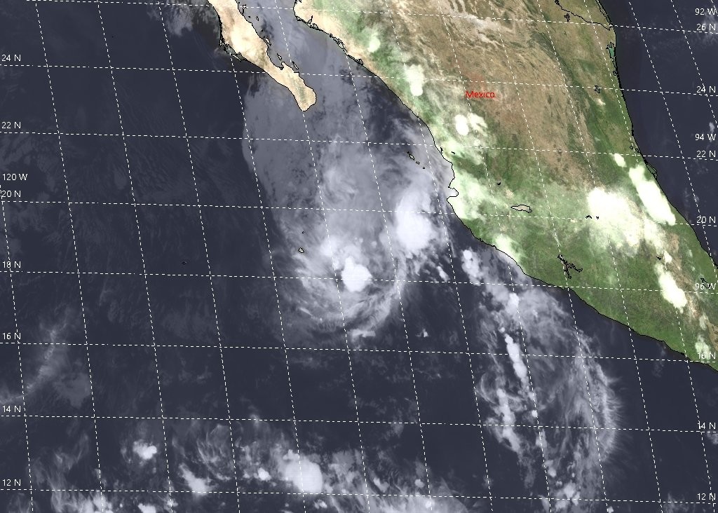
Tropical Storm Norbert maintains its strength for now yet is expected to begin weakening later today. Location is about 360 km WSW of the southern tip of Baja California with maximum sustained winds of 65 km/h (40 mph).
https://blog.baja-weather.com/post/631955269220515840/1410norbert
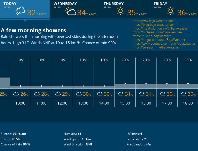
Tuesday 13. October 2020:
Cloudy with rain ending for the afternoon. Expected peak temperature 31°C.
Winds NE at 15 to 25 km/h.
Chance of rain 80%.